


|
Advanced Grades |
|
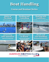
Boat Handling
Grade: S
Students who complete the 2019 Boat Handling course and pass the exam will receive credit for the Boat Handling course and earn the Seaman grade. They will also receive seminar credit for each of the class sessions attended. Student books are available in eBook or printed format. US Coast Guard Books are available in printed format or downloaded from the Cost Guard.
|
 |
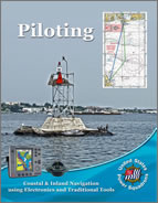
Piloting
Grade: P Piloting is the first course in the sequence of USPS courses on navigation, covering the basics of coastal and inland navigation. This course focuses on navigation as it is done on recreational boats today and embraces GPS as a primary navigation tool while covering enough of traditional techniques so the student will be able to find his/her way even if their GPS fails. The course includes many in-class exercises, developing the student’s skills through hands-on practice and learning. Ten classes of two hours each normally are scheduled for presentation of this course. In addition the students have seven days to complete the open book exam. Topics covered include:
|
 |
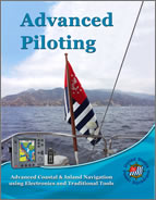
Advanced
Piloting Grade: AP Advanced Piloting is the second in the sequence of USPS courses on navigation. It continues to build coastal and inland navigation skill, allowing the student to take on more challenging conditions – unfamiliar waters, limited visibility, and extended cruises. GPS is embraced as a primary navigation tool while adding radar, chartplotters, and other electronic navigation tools. As with Piloting, the course includes many in-class exercises, advancing the student’s skills through hands-on practice and learning. Ten classes of two hours each normally are scheduled for presentation of this course. In addition the students have seven days to complete the open book exam. Topics covered include:
|
 |
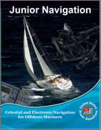
Junior
Navigator Grade: JN Junior Navigation is the first in a two-part program of study in offshore navigation, followed by the Navigation course. It is designed as a practical "how to" course. Subject matter includes:
In Junior Navigation, the student will continue to use GPS as the primary position sensor, as they learned to do in Piloting and Advanced Piloting. However, the offshore environment poses many different elements for consideration by the Navigator. Ocean currents, wind, and sea state all affect a vessel's performance over the longer passages. Also, visible terrestrial landmarks are no longer available to the navigator as reference points. In the Junior Navigation course, the student will learn to substitute celestial objects such as the sun as reference points. The course begins with the study of celestial navigation, teaching the student to take sights on the sun with a marine sextant and derive a line of position from that observation. Next, the student will apply the principles learned in Advanced Piloting, and plot a running fix from two sun sights taken about four hours apart. Once the student has learned the basics of celestial sight reduction, the course continues with planning, positioning, and checking one’s position in the offshore environment, using both electronic and celestial tools.
|
 |
|
After Junior Navigation, this course is the second part of the study of offshore navigation, further developing the student's understanding of celestial navigation theory. This Navigation 2015 course deals with learning celestial positioning using other bodies, in addition to positioning using the sun (covered in the Junior Navigation course). This course also deals with electronic software tools that can be used to plan and execute an offshore voyage. You will first learn to reduce these sights by the Law of Cosines method. Later in the course, you will learn an additional method of sight reduction, the Nautical Almanac Sight Reduction (NASR) method. You will also learn about sight planning techniques. With that knowledge, you will have the tools to take sights and complete your Navigation Sight Folder. The course includes a chapter on using a software-based voyage planning tool and a navigation program. The final chapter of the course contains a Practice Cruise that ties the separate elements of the course together. Chapter 1. A View of our Solar System. A simple overview of how the celestial bodies in the sky appear to us on earth. Chapter 2. Sunrise...Sunset. Finding local mean time of solar and lunar phenomena and converting the time of these events to zone time. Chapter 3. Taking Sights and Finding Ho, LHA, and Dec. Taking sights on the moon, navigational planets and stars; applying proper altitude corrections to these sights to obtain Ho; applying corrections for low altitude sights; and computing the LHA and declination of these bodies. Chapter 4. Sight Reduction and Plotting by the Law of Cosines. Reducing sights of the moon, stars, and planets by the Law of Cosines method; and plotting lines of position (LOPs) for these sights to obtain an estimated position, a running fix, and a true fix. Chapter 5. Sight Reduction and Plotting by the NASR method. Reducing sights on the sun, moon, stars, and planets by the Nautical Almanac Sight Reduction (NASR) method; and plotting the lines of position (LOPs) for these sights to obtain an estimated position, a running fix, and a true fix. Chapter 6. Sight Planning. Planning your sights to achieve good 2- and 3-body fixes, using both traditional and electronic tools. Chapter 7. Emergency Navigation. Provisioning an emergency navigation kit and constructing emergency plotting sheets; and determining destination coordinates mathematically from course and distance traveled. Chapter 8. Electronics and Software for Offshore Navigation. Using a software-based voyage planning tool to plan an offshore voyage (Visual Passage Planner 2); and using a navigation program in executing the voyage (OpenCPN). Chapter 9. Underway. A review of the Navigator’s duties and USPS Plotting and Labeling Standards; and setting up and using a 900 series plotting sheet. The student will execute a leg of an offshore voyage using both electronic and traditional tools, including celestial positioning. This Practice Cruise is an excellent preparation for the open book exam. |
 |
Courses Offered

Advanced
Grades
Elective Courses
Seminars
Learning Guides
Educational Calendar
Course Calendar